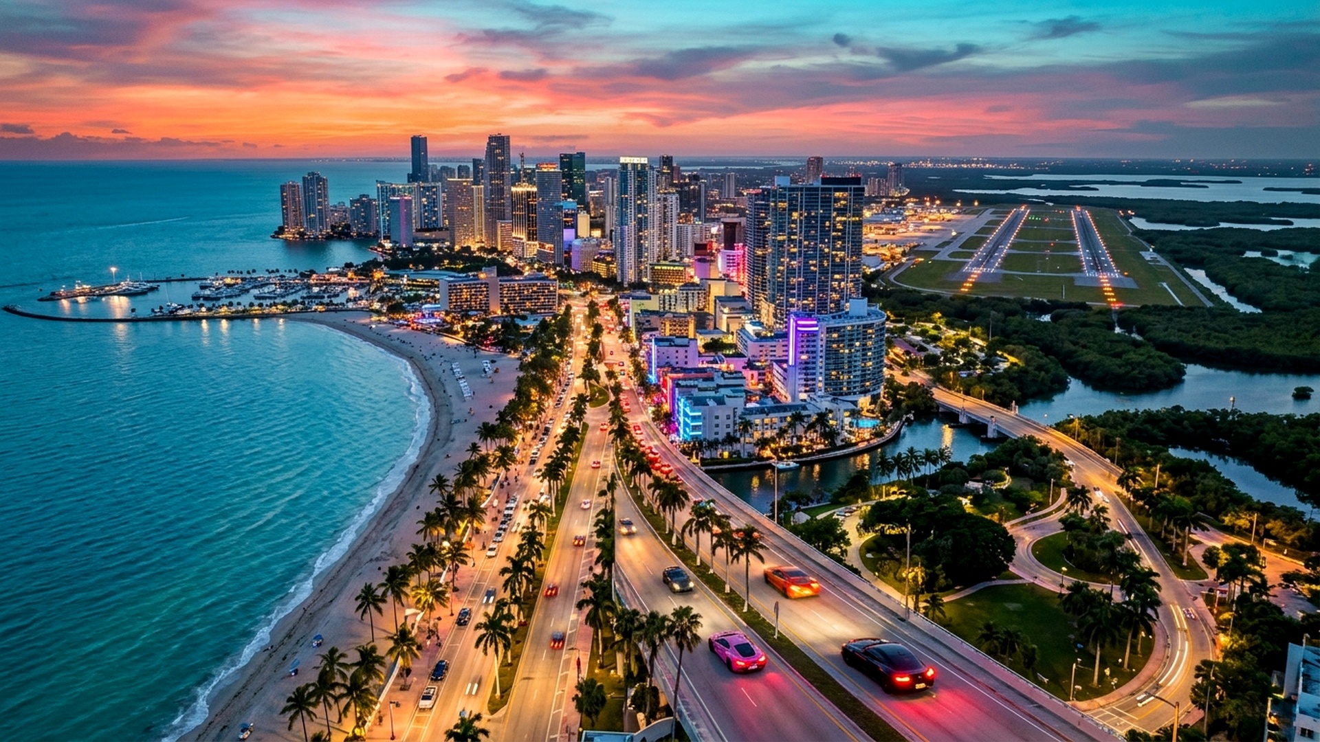
The gaming world continues to scrutinize every frame of telemetry and topographic leak emerging from Rockstar Games’ highly anticipated State of Leonida. While previous franchise entries delivered dense urban sprawl, Grand Theft Auto VI represents a paradigm shift in geographical scale, ecological variety, and volumetric depth. The virtual recreation of modern Miami and its surrounding Floridian ecosystems promises not merely a larger surface footprint, but an unprecedented degree of verticality, environmental physics, and interactive interior spaces.
Community mapping projects and spatial coordinate analyses suggest that the total traversable landmass of Leonida will eclipse Grand Theft Auto V’s Los Santos and Blaine County by a factor of 2.3 to 2.7 times. When factored alongside comprehensive maritime zones, barrier islands, mangrove swamps, and deep-sea trench networks, the operational playground expands even further. Understanding the layout of Vice City, its surrounding municipalities like Port Gellhorn, and the remote Grassrivers wetlands is essential for players preparing to dominate the criminal underworld on launch day.

Geographical Scale & Surface Area: Leonida vs. Los Santos & Red Dead Redemption 2
To quantify the monumental scale of GTA 6, data cartographers have assembled coordinate meshes extracted from Rockstar’s official trailers and background patent filings. In GTA V, the landmass measured approximately 75 to 80 square kilometers, with significant acreage consumed by impassable mountain ranges in Mount Chiliad and the Senora Desert. Conversely, Leonida’s topography embraces a predominantly flat, delta-centric basin, ensuring that over 88% of the mapped land is fully navigable by road, off-road vehicle, or airframe.
Furthermore, Rockstar’s proprietary RAGE 9 engine introduces volumetric simulation layers that transform flat topography into dynamic obstacle networks. High-tide cycles actively submerge low-lying coastal sandbars, transforming off-road trailways into treacherous swamp channels. The transition between densely populated metropolitan hubs and untamed wilderness feels continuous, eliminating the artificial borders and sterile transition zones seen in previous open-world sandbox designs.
| Open-World Title | Estimated Landmass (sq km) | Navigable Interior Ratio | Maritime / Underwater Acreage | Major Urban Centers |
|---|---|---|---|---|
| Grand Theft Auto VI (Leonida) | 185 – 210 sq km | Est. 45% – 55% of all structures | High (Barrier Reefs, Keys, Trenches) | Vice City, Port Gellhorn, Ambrosia |
| Grand Theft Auto V (San Andreas) | 76 – 81 sq km | Approx. 8% – 12% of structures | Moderate (Basic Coastlines) | Los Santos, Paleto Bay, Sandy Shores |
| Red Dead Redemption 2 | 75 sq km | Approx. 65% of cabins & stores | Low (River & Lake Systems) | Saint Denis, Valentine, Blackwater |
| GTA: San Andreas (2004) | 36 sq km | Under 4% (Interiors Gated) | Minimal | Los Santos, San Fierro, Las Venturas |
Key Metropolises, Suburbs & Industrial Corridors
The metropolitan core of Vice City serves as the beating heart of Leonida’s commercial and illicit enterprises. Structured as a sprawling coastal network of interconnected islands and causeways, the city divides into distinct socio-economic zones that mirror real-world South Florida demographics:
- Vice Beach & Ocean Drive: The quintessential art-deco beachfront promenade characterized by neon-lit hotel facades, luxury high-rises, rollerbladers, and exotic hypercar parades. Pedestrian density in this district exceeds anything previously rendered on current-gen consoles.
- Downtown Vice & Financial Center: Soaring commercial skyscrapers, banking headquarters, rooftop helipads, and rapid-transit monorail tracks. High-end penthouse suites in this district serve as primary hubs for white-collar heists and money laundering.
- Little Haiti & Industrial Rail Yards: Gritty urban warehouses, shipping depots, chop shops, and low-income residential row houses. Street gangs and local cartels maintain heavily fortified compounds within these industrial alleyways.
- Port Gellhorn & Gulf Coast Suburbs: Located on the western rim of the map, Port Gellhorn represents an industrial port city dominated by shipping drydocks, cargo crane hubs, oil refineries, and working-class dive bars.
Aviation Infrastructure: Multi-Runway International Airports & Rural Airstrips
Aviation enthusiasts will find Leonida to be Rockstar’s most technically sophisticated airspace to date. In GTA V, Los Santos International Airport (LSIA) featured parallel paved strips but lacked realistic taxiway protocols and perimeter security logic. In GTA 6, Vice City International Airport is engineered as a massive, multi-terminal transportation nexus with four full-length crossing runways capable of accommodating wide-body commercial jets and military transports simultaneously.
Beyond the primary international airport, satellite airstrips and hidden smuggler runways dot the outer wilderness. The Gator Keys and southern archipelagos feature unpaved coral-gravel strips historically utilized by clandestine contraband cartels. Players piloting twin-engine turboprops must calculate crosswind drift, radar evasion altitudes, and runway clearance when touching down on remote marshland islands without lighted approach beacons.
| Aviation Facility | Location Region | Runway Configuration | Security Threat Level | Available Aircraft Types |
|---|---|---|---|---|
| Vice City International | Southwestern Metropolis | Quad-Runway Interlocking Paved | High (FAA & Homeland Security) | Jumbos, Executive Jets, Helicopters |
| Port Gellhorn Regional Airfield | Western Gulf Coast | Dual Paved Strip with Hangars | Medium (Local Municipal Police) | Cropdusters, Stunt Planes, Helis |
| Keys Smuggler Strip | Southern Barrier Keys | Single Unpaved Dirt / Coral Bar | Low (Unmonitored Pirate Haven) | Bush Planes, Amphibious Sea Planes |
| EOD Military Airbase Depot | Northern Forest Foothills | Hardened Reinforced Runway | Extreme (5-Star Lethal Defenses) | Fighter Jets, Gunships, VTOLs |
The Grassrivers, Mangrove Deltas & Wildlife Dynamics
Leonida’s wilderness ecosystems depart sharply from traditional arid deserts. Inspired by the Florida Everglades, the Grassrivers region represents a labyrinth of shallow waterways, dense sawgrass prairies, and murky cypress swamps. Standard wheeled vehicles will instantly bog down in mud flats, making fan-propelled airboats and specialized hovercraft the premier modes of transportation.

Rockstar’s advanced wildlife simulation creates an unpredictable predatory environment. The swamp waters teem with massive American alligators, bull sharks that navigate inland brackish estuaries, and venomous water moccasins. Hunters and smugglers operating deep in the bayous must remain vigilant during nocturnal expeditions, as dynamic fog banks reduce visibility to less than ten meters while predator audio cues echo through the marshes.
Maritime Depths: Sunken Galleons, Coral Atolls & Scuba Mechanics
Water gameplay has evolved from an incidental novelty into a primary gameplay dimension. The continental shelf surrounding the Keys drops precipitously into deep oceanic abysses, punctuated by living coral reefs, underwater cave systems, and historic colonial shipwrecks. Players equipped with specialized scuba gear and motorized diving scooters can explore submerged military freight planes, derelict smuggling vessels, and hidden underwater vaults containing high-value contraband.
Underwater acoustics and pressure limits add tactical depth to maritime exploration. Deep-sea diving beyond certified depth gauges causes rapid decompression damage unless players utilize specialized submersible craft. Furthermore, coastal drug patrols deploy sonar scanning buoys, forcing players transporting ocean-dropped payloads to navigate narrow coral canyons to evade federal watercraft.
Strategic Takeaways for Leonida Explorers
- Acquire Amphibious Craft Early: Investing in airboats and seafaring amphibious trucks provides rapid bypass routes around heavily congested toll causeways connecting Vice Beach to the mainland.
- Map Offshore Fuel Docks: High-speed aquatic pursuits burn marine fuel rapidly; memorize coastal marinas and hidden fuel caches situated along the Florida Keys chain.
- Scout Smuggler Ingress Points: Utilize low-altitude radar-evading flight paths across the Grassrivers to deliver illicit cargo without triggering county sheriff intercept units.
- Prepare for Variable Weather: Tropical storm fronts generate severe storm surges, swelling canal water levels and temporarily rendering ground underpasses impassable.
For more detailed tactical guides and gameplay breakdowns, explore our definitive analysis on GTA 6 Cheat Codes & Console Commands or check our economic breakdown of GTA 6 Real Estate & Money Laundering Mechanics.


Community Cartography Projects & GPS Telemetry Findings
Over the past eighteen months, dedicated GTA community cartographers have meticulously cross-referenced highway markers, radio tower silhouettes, and skyline angles visible across leaked development footage and official promotional reels. By calculating vanishing points and triangulation vectors against real-world Miami GIS data, the community mapping coordination group has constructed an accurate topographical skeleton of Leonida’s road grid.
One of the most remarkable discoveries centers on the highway transit system. Unlike the single loop highway that encircled San Andreas, Leonida incorporates a multi-tiered interstate network with toll express lanes, elevated flyovers, and drawbridges spanning coastal canals. Law enforcement AI is programmed to deploy tactical roadblocks and spike strips across these elevated bottlenecks, transforming high-speed police pursuits into complex navigation challenges where taking an off-ramp into marshland terrain may be the only avenue of escape.
| Highway Route | Connecting Municipalities | Toll Booth Stations | Patrol Intensity |
|---|---|---|---|
| Leonida Interstate 97 | Vice City Core to North Border | Automated SunPass Cameras | Heavy State Trooper Cruisers |
| Ocean Causeway Bypass | Downtown to Vice Beach Islands | Dual Drawbridge Checkpoints | Vice City Police Department (VCPD) |
| Gellhorn Freightway | Port Gellhorn to Industrial Yards | Weigh Stations & Cargo Scanners | County Sheriff Interceptors |
Related posts:
 GTA 6 Official Release Date, Editions Pricing & Map Guide: Full Rockstar Intel
 GTA 6 Launch Guide 10 Days Out: Editions, Pre-Load Schedule, Leonida Map Size & Rockstar Console Launch Details
 Take-Two Q2 FY2027 Earnings & GTA 6 November 19 Launch Countdown: $8.2B Bookings Forecast, 7.7M Pre-Orders & Preload Schedule
 GTA 6 5-Day Launch Countdown: Global Midnight Unlock Map, 200GB Pre-Load Verification & PS5 Pro vs Base Performance Modes